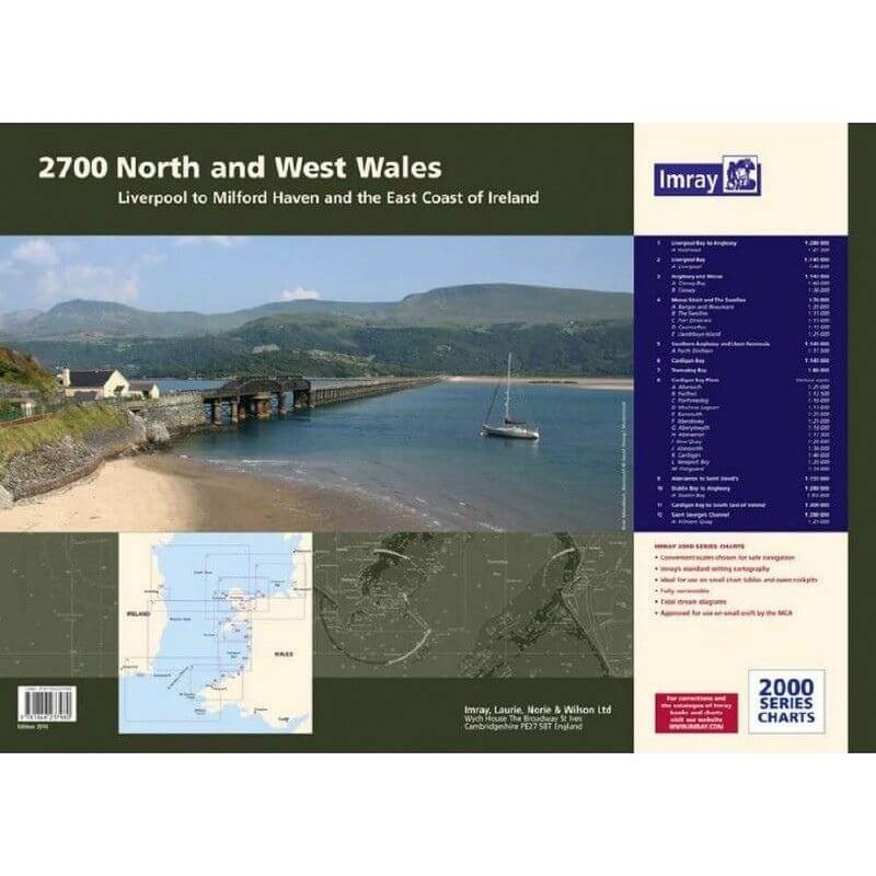
Description
Imray 2700 North & West Wales Chart Pack | YOT0859 ISBN 9781786794963
Covering the Welsh coast from Liverpool Bay to St David’s in a folio of 12 handy wire-bound A2 charts in a sturdy plastic wallet.
The chart pack includes all the navigational charts and tidal data for passage, approach and mooring.
Idea for small craft.
Included
- 2700.1 Liverpool Bay to Anglesey including plan of Holyhead
- 2700.2 Anglesey and Menai including plans of Conwy Bay and Conwy
- 2700.3 Southern Anglesey and Llyen Peninsula including plan of Porth Dinllaen
- 2700.4 Cardigan Bay to South East of Ireland
- 2700.5 Cardigan Bay
- 2700.6 Aberaeron to St David’s
- 2700.7 St George’s Channel with plan of Kilmore Quay
- 2700.8 Menai Strait and The Swellies with plans of Bangor and Beaumaris, The Swellies, Port Dinorwic, Caernarfon, Llanddwyn Island
- 2700.9 Cardigan Bay plans Abersoch, Pwllheli, Porthmadog, Mochras Lagoon, Barmouth, Aberdovey, Aberystwyth, Aberaeron, New Quay, Aberporth, Cardigan, Newport Bay, Fishguard
- 2700.10 Tremadog Bay
- 2700.11 Dublin Bay to Anglesey with plan of Dublin Bay
- 2700.12 Liverpool Bay with plan of Liverpool


Reviews
There are no reviews yet.